

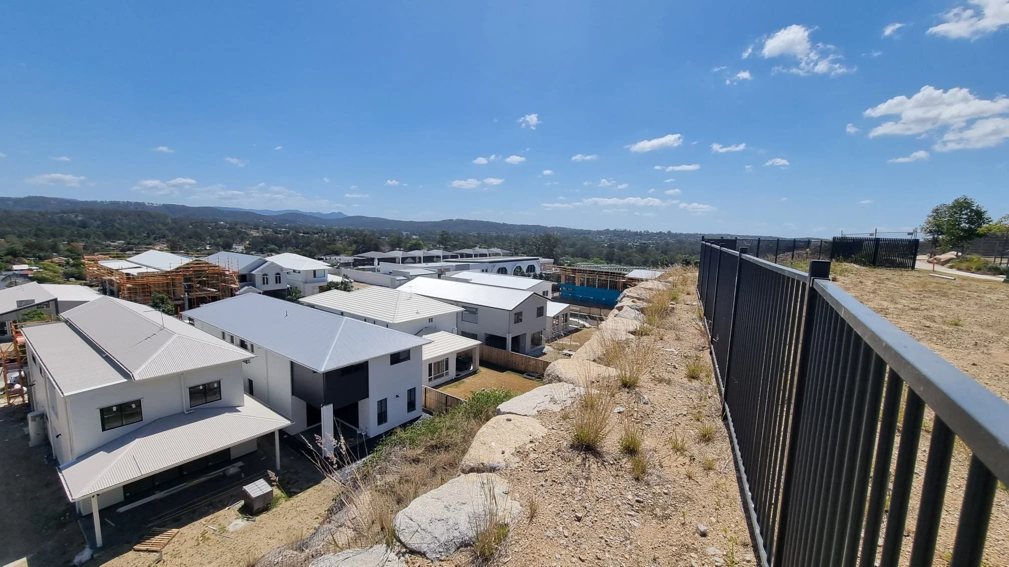
Flood Reports and Flood Assessments for Brisbane City Council
Flood Smart Engineering prepares flood reports and flood engineering assessments for residential, commercial, industrial and subdivision developments throughout Brisbane. We assist homeowners, builders, developers and consultants in understanding flood constraints, satisfying Brisbane City Council requirements and obtaining development approval.
Our assessments include flood impact assessments, flood immunity assessments, hydraulic modelling and overland flow assessments, providing practical engineering solutions tailored to each development.
How We Can Help
If your property is affected by Brisbane City Council's Flood Overlay or Overland Flow Overlay, a flood engineering assessment may be required before development can proceed.
Flood Smart Engineering regularly assists Brisbane clients with:
Flood Reports
Flood Engineering Assessments
Flood Impact Assessments
Flood Immunity Assessments
Hydraulic Modelling
Overland Flow Assessments
Whether you're planning a house raise, new dwelling, extension, subdivision or commercial development, we can assess your property's flood constraints and prepare the engineering documentation required to support council approval.
Our experience in Brisbane
Over the years we have worked on a large number and variety of projects in the Brisbane region. The most common development applications we assist with are:
✓ Knockdown-rebuilds
✓ Subdivisions
✓ Townhouses
✓ Apartment buildings
✓ Commercial precincts
✓ Industrial depots
Our local knowledge and expertise has contributed to our understanding of specific flooding characteristics within Brisbane City Council ie. flooding from waterways such as Kedron Brook, Bulimba Creek, Enoggerra Creek and more.
Brisbane Suburbs We Commonly Service
At Flood Smart Engineering, we regularly assist our clients throughout the Brisbane suburbs of Chermside, Nundah, Ashgrove, Kedron, Carindale, Oxley and many more. There is a high chance we have worked on a project within your local area.
Brisbane City Council Planning Scheme
Brisbane City Council requires flood assessments when located in the following overlays:
Brisbane River Flood Planning Area
Creek/Waterway Flood Planning Area
Overland Flow Flood Planning Area
Coastal Hazard overlays
These overlays are used as triggers for assessment against the respective overlay codes as part of Brisbane City Council’s Planning Scheme.
The following interactive map displays all the overlays your property may be affected by: City Plan 2014
Steps to Follow
The following steps will assist you in identifying the flood overlays affecting your property:
Go to Brisbane City Council’s City Plan 2014
Search for your property address
In ‘Map Tools’ (right side of the website), click ‘Flood’
Filter through the Brisbane River, Creek/Waterway and Overland Flow Flood Planning Area overlays
For the Coastal Hazard overlays, click ‘Coastal hazard’ and filter through the overlays
The FloodWise Property Report also identifies the flood overlays affecting your property (discussed in the next section)
The screenshot below shows the Brisbane City Council City Plan 2014 (Interactive mapping system).
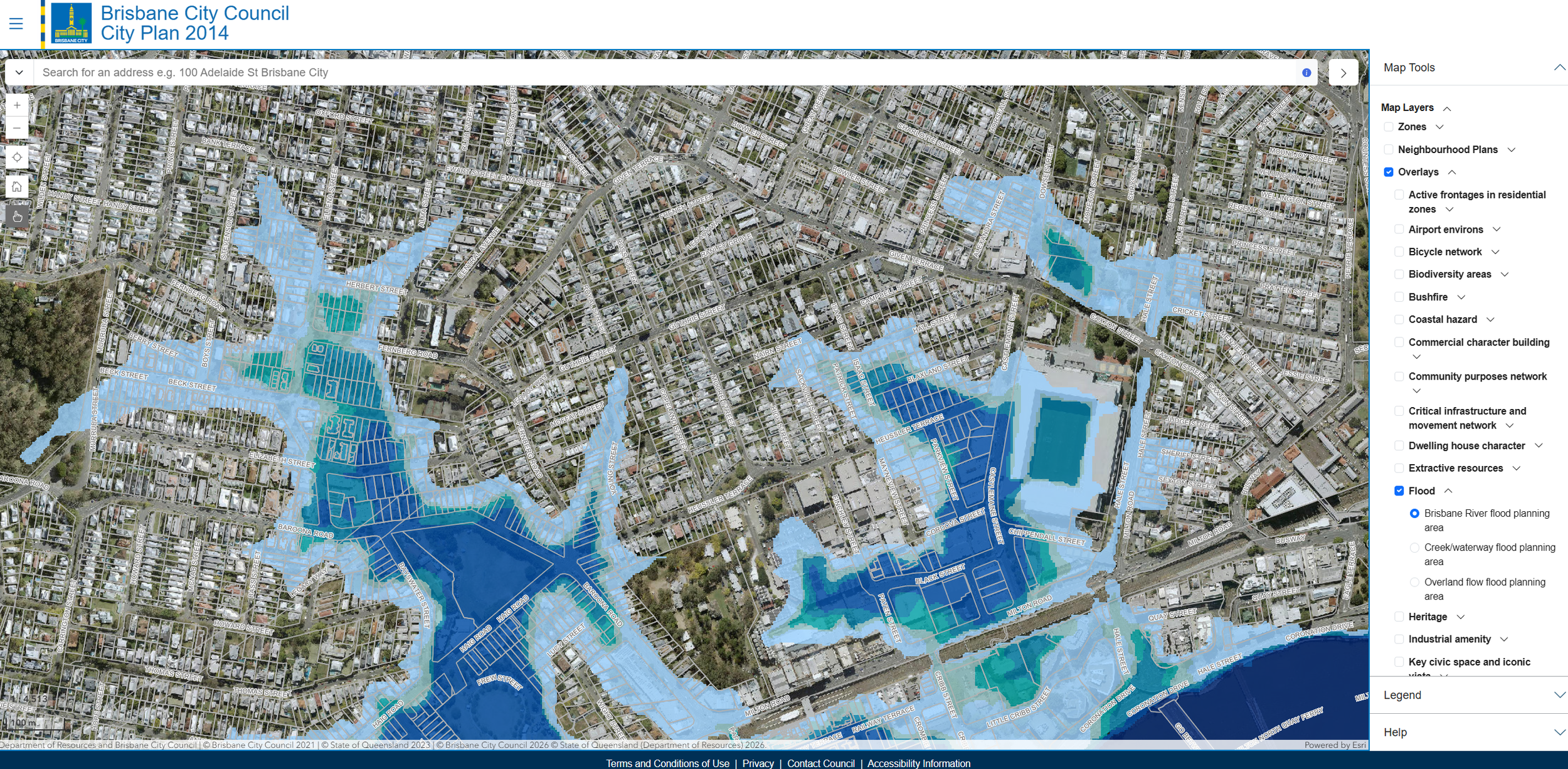
Brisbane City Council City Plan 2014 (Interactive Mapping System)
Brisbane City Council Floodwise Property Report
Brisbane City Council provides property reports specific to flood overlays, including the following:
Sources of flooding/inundation
Flood level data (design and historic)
Flood and coastal hazard planning areas
Ground level estimates
The flood levels in these reports are used to set minimum floor/design levels. Please note that these reports do not provide overland flow levels.
Steps to Follow
The following steps will assist you in retrieving a FloodWise Property Report:
Go to Brisbane City Council’s Flood Awareness Map
Search for your property address
Click ‘Technical Floodwise Property Report’ (right side of the website)
A new tab will open with the report, ready for download
The screenshot below shows the Brisbane City Council Flood Awareness Map.
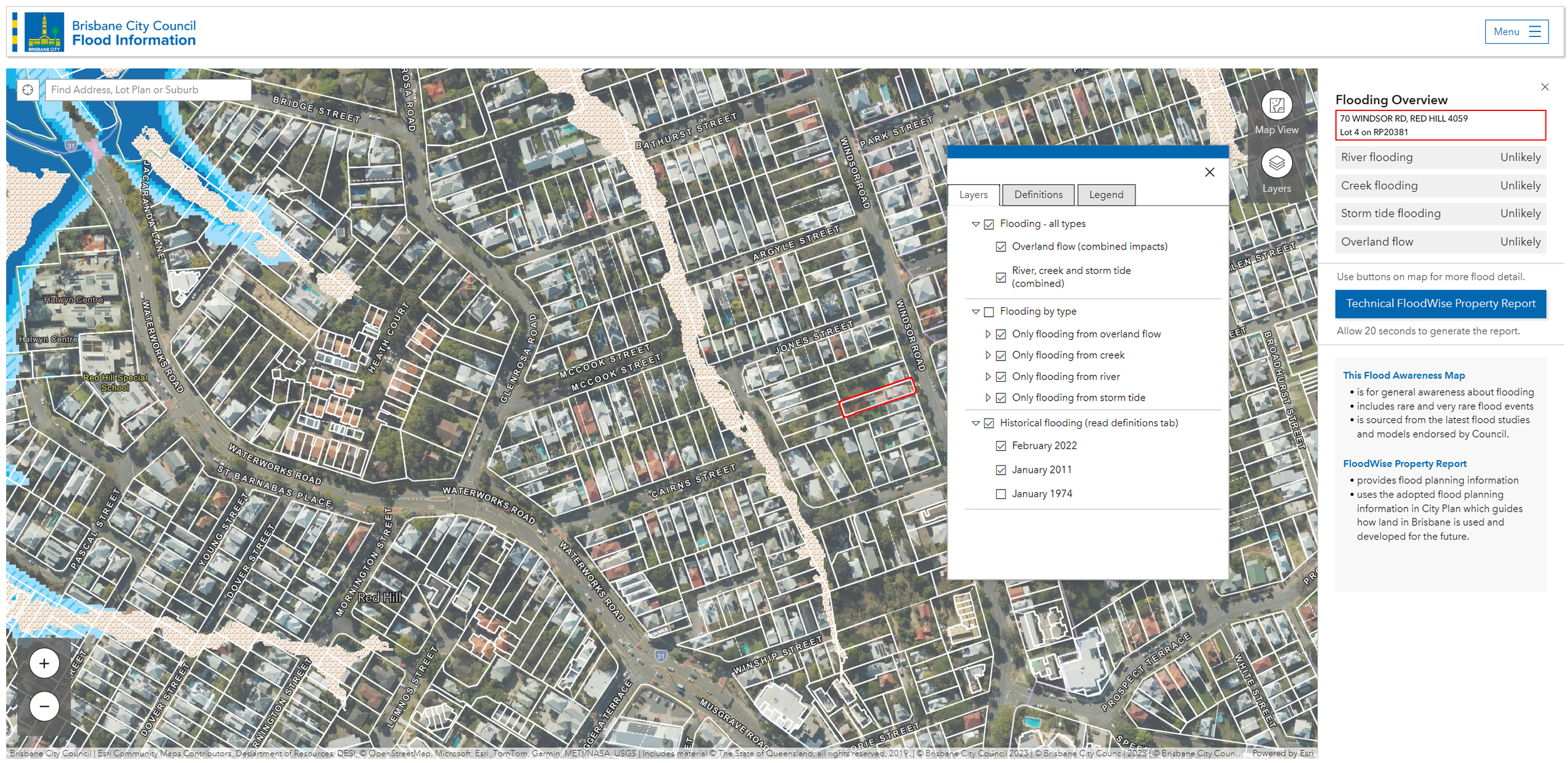
Brisbane City Council Flood Awareness Map
Brisbane City Council Flood Awareness Map
Brisbane City Council provides additional flood mapping, including the following:
Design flooding extents
More detailed overland flow extents
Historic flooding extents
Flood definitions and information
The Flood Awareness map is best used to identify more detailed overland flow path/extents and historic flooding from January 1974, January 2011 and February 2022. The Flood Awareness Map can be accessed via the following link: Flood Awareness Map
Steps to Follow
The following steps will assist you in identifying flooding affecting your property:
Go to Brisbane City Council’s Flood Awareness Map
Search for your property address
Click ‘Layers’ (right side of the website)
Filter through the layers and tabs
The screenshot above shows the Brisbane City Council Flood Awareness Map.
To view past and current applications in Brisbane City Council, visit the Development.i page.
Brisbane City Council’s latest interactive maps, the Community Maps, allow users to view specific information from stormwater utilities to transport parking areas. Use the pages below to view the specific maps:
Community and recreation - Explore Council facilities, parks, electoral boundaries and more
Land and environment - Explore waterways, protected vegetation, elevations and more
Transport - Explore public and active transport, parking and more
Utilities - Explore stormwater, sewer, water and recycled water
Flood Engineering Services We Provide
These assessments are required by Brisbane City Council to ensure that adverse flood impacts are not created which may negatively affect neighbouring properties, the surrounding area and more.
During this assessment, the construction type and location is usually determined. This may involve altering the amount of filling on your property, constructing on a suspended slab or creating flood-specific channels.
Flood Immunity Assessments:
Brisbane City Council requires various types of development to meet various flood immunity requirements so that floor levels are safe during overland flow and flood events.
This usually involves habitable floor levels, non-habitable floor levels, servicing levels and the ability for site occupants to traverse the site without being exposed to flood hazard.
Flood Risk Assessments:
When flooding may impact upon the ability for site occupants to traverse or evacuate a site, flood risk and flood emergency matters are to be addressed.
This usually involves evacuations plans, understanding of flood warning times, flood recovery considerations and more.
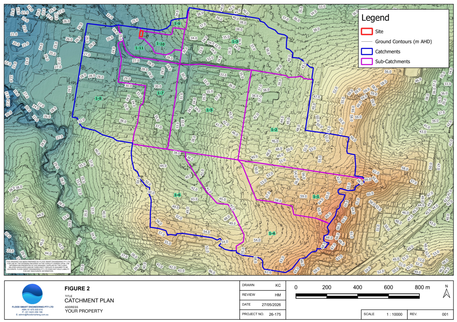
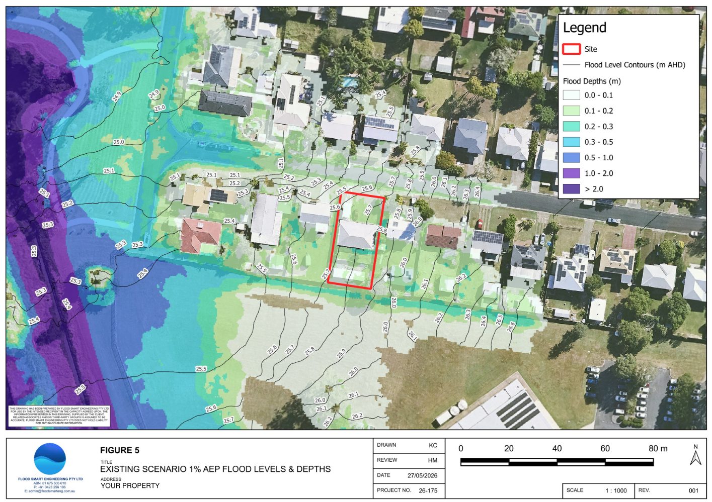
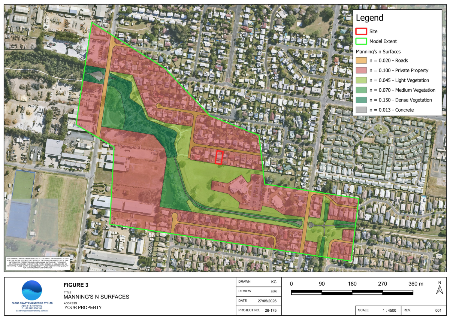
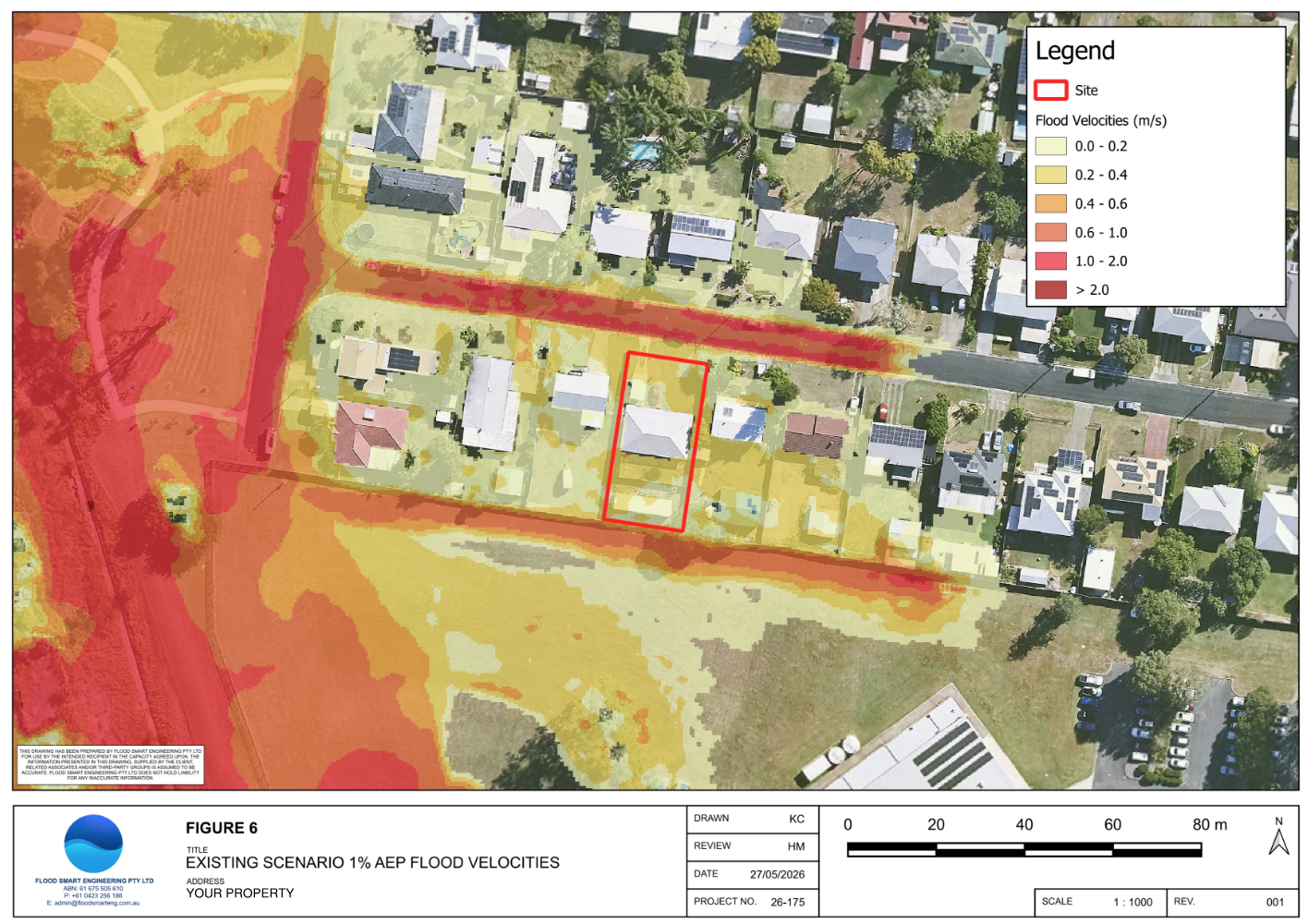
Overland flows paths are quite common in Brisbane City Council due to the constant elevation changes. Brisbane City Council does not typically provide flood data for overland flow paths. As such, it is important that overland flow assessments are undertaken through our TUFLOW hydraulic models to determine their characteristics and impact upon your property and future development.
At Flood Smart Engineering, we utilise TUFLOW hydraulic models to produce flood levels, velocities, hazards and extents for inundations sources such as overland flow. These models provide site-specific results so that we can focus on increasing development opportunity for your property and gaining council approval through the building application (BA) and development application (DA) phases.
FAQs
Do I need a flood assessment for my property?
1
If you are located in a flood overlay, you will most likely require a flood assessment to be undertaken. Flooding can be a complex issue and requires a keen eye to identify development opportunity. Please contact us and we can assist you with your property.
What is a FloodWise Property Report
2
The FloodWise Property Report identifies the flood overlays and flood levels affecting your property. Please note that overland flow levels are not shown on these reports; hydraulic models are to be produced to determine these levels.
Can I build in a flood overlay?
3
Flood overlays can be built in as long as compliance with Brisbane City Council’s Planning Scheme is achieved. Some properties have more development potential than others.
View the other councils we regularly work in.
Brisbane Logan Gold Coast Ipswich Moreton Bay Sunshine Coast
What experience do you have in Brisbane City Council?
4
Majority of our work is located within Brisbane City Council which has contributed to our local expertise. We have worked a range of projects including renovations, knockdown-rebuilds, subdivisions, apartment buildings, townhouses, commercial and industrial developments.
Flood report costs vary depending upon the flooding type and complexity. Please contact us and we can prepare a formal proposal for your consideration.
A flood report is usually required for a building application (BA) or development application (DA) in Brisbane City Council. It is best to engage us as early as possible as the flooding component for a development can be crucial in determining engineering design.
How much does a flood report cost?
5
When do I need a flood report?
6
Brisbane City Council requires developments to meet flood immunity requirements. To be flood immune is to be free of/not affected by flooding for a given design flood event. The requirements generally include freeboard (an additional margin/height above the applicable flood level) to ensure adequate safety and consideration to design components.
What is flood immunity?
7
Need a Flood Report for your Brisbane Property?
Whether you're planning a new home, subdivision, extension or commercial development, Flood Smart Engineering can prepare the flood engineering assessment required for council approval.